A Christmas Postcard. Hawkes Bay December 2016

IMG_0641.jpg

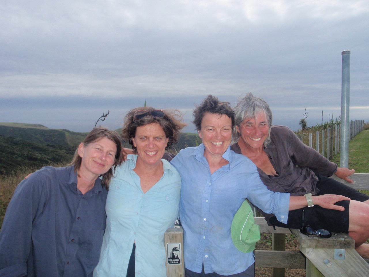
Christmas Greetings from Hawkes Bay where I am loving my extended holiday tending my aging father and slowly unwrapping the landscape of my childhood. 

I have been thinking about landscape a lot here. I am reading The Old Ways by Robert Macfarlane, which is probably influencing me. He talks of “the substance of landscape so influencing mind that mind’s own substance is altered”.

Hawkes Bay’s golden hill, big sky landscape has always been a part of me but I am here long enough this time to feel like I am re-inhabiting it in a fresh way. Each day from where I am staying in Hastings I look up across the tops of verdant orchards and see the Havelock North hills. By that I mean the jagged back of Te Mata Peak, its slopes fanning away to the south and then the big rolling hills wrapping and tumbling over and over each other and around to the marbled folds of Mt Erin. These were the hills I used to ride my black pony Thomas Winchester over — the reins slack on his neck as I dreamed and imagined my way through adolescence. Those hills were my ‘dreaming place’.

Interestingly, just before my mother died eleven odd years ago she gave me her final instruction: to read Psalm 121 at her funeral “because you and I share a love of those Havelock Hills”. At the time it felt pretty weird standing in the Hastings Crematorium reading “I will lift up mine eyes unto the hills, from whence cometh my help….” But what do I do here every day? And sometimes Mum is there too!

So it is lovely to be back here inside my history.

There is so much abundance in Hawkes Bay, in so many ways, though you do have to accept that there is a cost to the environment to produce it. (Lots of orange “horticultural spraying” signs about).

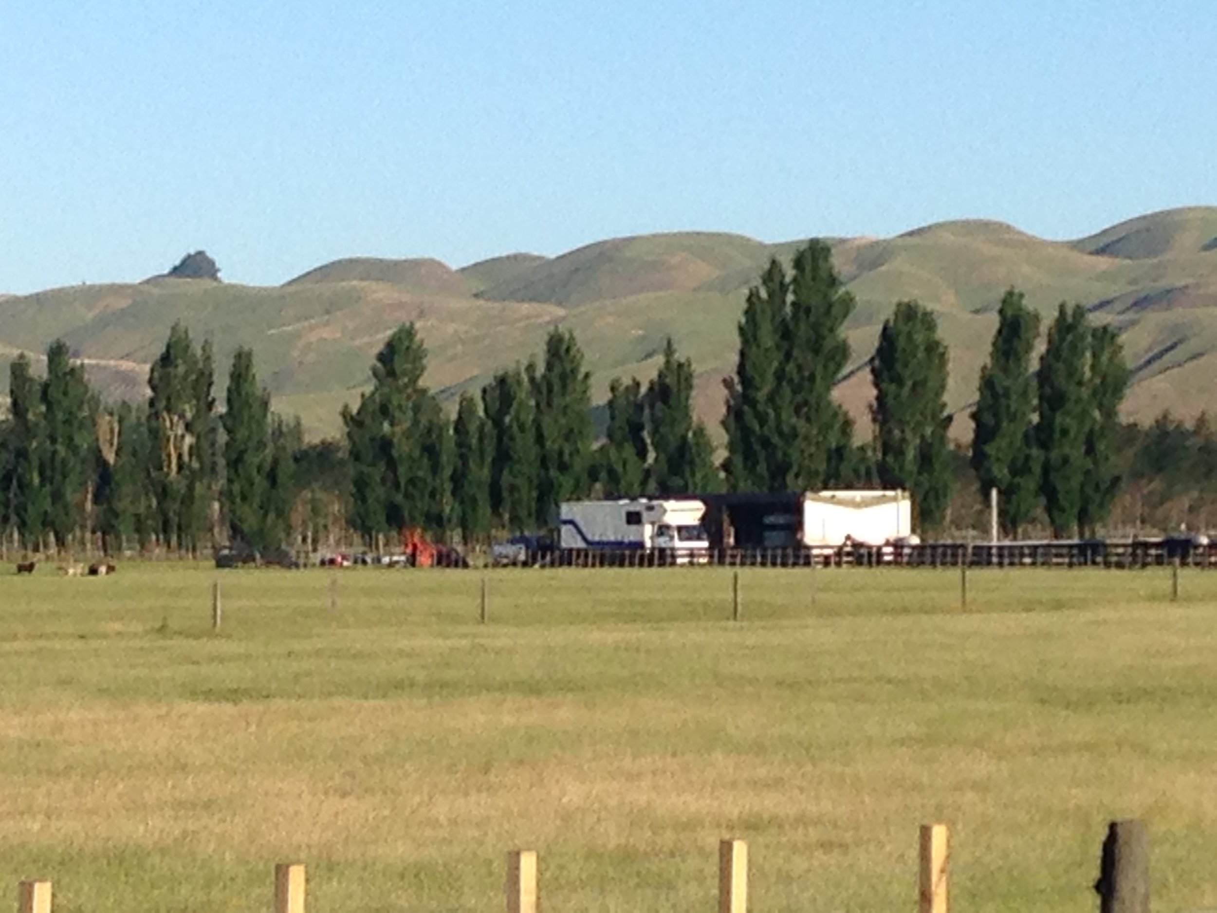
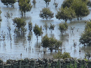
Abundance? Big boxes of juicy ripe cherries cheap as chips. Me biking down a country lane clutching a brown paper bag bulging with juicy, early apricots from the nearby organic orchard …so delicious I can’t resist stopping to eat en route. The groomed vineyards everywhere. The rows and rows of apple orchards. The fields of cultivation. The sea nearby. The bare white limestone cliffs of Cape Kidnappers hemming Hawke Bay. The blue haze of the Ruahine and Kawekas on the opposing horizon to the Havelock Hills. The three wide rivers: the Tuki Tuki, Ngaruroro and Tutaekuri – huge veins on the face of the Heretaunga Plains.  I had never really stopped to think about the geography of Hawkes Bay but I am learning that as much as it is a story of its hills, it is the story of its rivers.  A water story – but not of the campylobacter kind.

Before early settlement the three rivers flowed down from the Ruahine and Kawekas to the sea often flooding and changing course, building up a huge aquifer that is underneath the Heretaunga plains and dumping alluvium into the soils doubling their richness and fertility.  In 1897 the Ngaruroro flooded its banks near Clive, lives were lost and since then the rivers have been tamed with huge stop banks built either side and their flow trained towards fixed mouths. The 1931 earthquake altered things further lifting land up out of the Ahuriri Lagoon.  The upside of all this is that today the Heretaunga Plains are a biking paradise with tracks following the tops of the stop banks with big views across the land. In The Old Ways the chalk walkways in south England are described “as snakes in the green grass” just like the limestone bike trails of Hawkes Bay – many of which I have zoomed over while here.

And then there is the fertility of the Heretaunga Plains, which is a segue-way into another spoke of my history.  My grandfather, who came up to Hastings from Nelson after fighting in World War 1 started a grain and seed business in Hastings called A.F. Redgrave and Co. and then doubled his fortunes when he met a young man call James Wattie who invited him to invest in a burgeoning canning business.

IMG_0734.jpg

Frank Redgrave became one of the Wattie company directors and made enough money from his shares to become an early land developer in Havelock North. One childhood memory is the boxes of free, freshly canned HB golden queen peaches and pears that would arrive at our front door every February/March.

It is also fertile ground spending a little of each day here with my 90-year-old Dad.  We drive around the streets of Havelock and Hasting and he won’t let me make one turn without saying: “This is the way. Not there!” He knows every street like the palm of his hand and doesn’t miss a beat on that score.  But this week he had his TV stolen at the Retirement Village (a first).  He’s been quite happy telling every shopkeeper and café owner we’ve dealt with, his story but he has also spent hours and hours trying to understand why he had to pay the first $250 excess before the insurance kicked in. He cannot fathom that the TV only cost $599/ not $5,999.  He just doesn’t get it. He is so sure that Joe Average TVs are worth between $5,000 - 10,000 today.  Dad who was always so sharp. Dad who is now living behind the times. He shakes his head and tries again and again to figure it out. But nope, he just can’t get it.

It is easy being with my Dad (most of the time).  I can’t help laughing at his silliness though.  He seems to cope with that.  I hope people laugh at me when I do silly things.


IMG_0701.jpg

Nothing but the birds: Manukau Harbour

First published Thursday, 24 February 2011

Free range on the Otuataua Stonefields and Watercare Walkway  

IMG_4450.JPG

For weeks I’d been carrying the metaphor of a safe harbour around in my head. It was time to weigh anchor, farewell calm waters and venture out through jagged heads to the open ocean beyond.

So when I find myself on a hot early summer’s afternoon staring into the distant blue-hazed throat of Auckland’s Manukau Heads, it’s as though I’ve retrieved the image from my imagination.  

As I squelch my way across the wet mudflats towards the retreating tide line my eyes pan around the huge “safe” harbour. It’s a revelation to learn the Manukau is New Zealand’s second largest natural harbour sprawling across 394 square kilometres of water surface at high tide.  I see Auckland through a fresh lens as I follow it's borders starting at South Head on the Awhitu Peninsula, crossing the channel to Burnett or Ohaka Head on the north side and then letting my eyes slide along the coast to Huia and Cornwallis. I pause at Puketuku, Auckland’s smallest volcano directly across the water in front of me, once called Week’s Island and before that intriguingly - island of the “Long Desired”. 

The Sky Tower’s ubiquitous needle poking into the grey cityscape is strangely comforting as my gaze sweeps across the wide skirt of One Tree Hill, mentally notes Mangere Mountain over there (huh! Mangere means lazy didn’t know that). 

The hot afternoon sun reflecting off the stonefields is like a giant heater behind me as my eyes zoom low winging their gaze over the mangroves out to distant Clarks Beach and Awhitu.  And then there again- way in the distance - those beguiling heads and all the harbour’s wide open mouth promises.

There is a Māori story that says the Manukau is named after the “anxiety” of Hoturoa  (Te-Manuka-O-Hoturoa) as he steered the great Tainui canoe across the Tāmaki isthmus towards the breakers at the harbour entrance. It’s thought the name Manuka, first applied to the heads, then extended to cover the harbour, and has since corrupted to Manukau. West Coast poet Paparoa Jeffery Holman draws on the story:

Manukau makes a name for itself (for John O'Connor)

When old Hotunui saw the breakers on the bar, part of him wanted Tainui out of there: "Aue, ka tāhuri tātou!"

They say that feeling got this town a name: Te Mānuka o Hotunui, fear of drowning. Now flying's taken over from the sea, as my way in to Manukau and terra firma, home at last from everywhere to Aotearoa - it almost feels the same.

"Get this thing down, big boy, that's the way!" Once those wheels hit tarmac and we roll, my stomach flips, my heart is in your hands.

Just think: somebody wanted to call the city Churchill, Polaris, Ngarimu, or even Savage (Michael J). Give me a seasick Hotunui any day.

I like another theory about the naming of Manukau. It suggests the name comes from the Māori manu for“bird”, and kau, “a swim”.  So “bathing place for sea birds”, or “place of the wading birds”, even better “nothing but birds” .  Of New Zealand’s 120,000 wader birds, 60,000 of them make their home for at least part of the year on the Manukau: arctic Wrybills and bar-tailed godwits, pied oyster catchers, pied stilts and the largest New Zealand population of threatened banded dotterels.

But all I see and hear are little black swallows tweeting in the sky just above me as Debbie, my walking mate, plucks her way across the mudflats and comes to a halt beside me.  She holds the camera round her neck clicking through close ups of the colourful old fishing boat wrecked on the shell bank back round the corner.

Interesting that Debbie and I have fetched up here on Labour Day Monday. Just two months earlier I’d gone with my teenage daughter for a weekend getaway to Whatipu Lodge tucked beneath cliffs on the northern edge of the Manukau.  

Debbie, an old school friend I hadn’t seen since “back in the day”, just happened to be staying at the lodge at the same time and we’d re-kindled a connection sharing the light of a dim torch on a cloudy night down at the beach searching for lollies in the black sand as part of a kids treasure hunt.  I wasn’t thinking about it then but we were adjacent to the notorious Manukau sand bar, site of New Zealand’s worst marine disaster: the HMS Orpheus which went down in 1863 along with 189 of its 257 crew.  Something must’ve seeped into my unconscious though because as the safe harbour metaphor surfaced a little while later so did warning bells about the dangers of navigating tricky heads. Wait for the right tide, said a little voice in my head, study the chart for snags and know the route before you depart. Aha! Hoturoa’s “manuka” was surfacing.  Yet there’d been none of that when Debbie and I set out on this walk.  The whole thing had been pretty random.

 “What about the Stonefields?  They’re pretty cool,”  I’d suggested as we sat on her Parnell balcony eating scrabbled eggs and cherry tomatoes. We might’ve sat there in hot sun all afternoon but our walking poles splayed against the railing were like panting dogs. They’ d been promised a walk and they weren’t going to stop glaring at us til we picked them up.

As I drove, Debbie consulted the map.  We passéd the Mangere poo ponds, round the mountain and headed out along the back of Auckland Airport.  We were talking so hard that we missed the official Otautaua turnoff and then found ourselves rambling down Ihumatao Road (the name of the local Māori papakainga), passéd the quarry and through a gate with a sign: locked at 9pm daylight saving . Further down the gravel road, Debbie gets out of the car to unlatch another gate and then on we go in a spirit of adventure rolling towards the sea and a little car park with three or four cars. We look at one another, pleased: without trying we’ve hit a local spot. As we get out of the car a big, burly Pacific Island man puffs up a little mud path straddling a huge blue plastic barrel on his shoulder.

“Can you get to the Stonefields from here?” Debbie asks. 

He and two younger mates who appear behind him pause thinking and then point to our right, over a high hedge. “That way!”

It’s enough for us. We pass some families picnicking on the beach and then clamber up a high wire fence, throwing our walking poles onto the grass below, then jumping after them.  A herd of black and white Fresian cows all dressed up in their Sunday best look bemused by our back entry to Otautaua.  

IMG_4479.JPG

The day is hot. Bright. Hot.  We cross the paddock, climb another fence and then stand amidst a huge crop of volcanic rock spread across the ground like acres of broken weetbix. It’s as though the land has a really bad dose of acne. Rocks which ever way you look. Yet its beautiful in an unexpected and wild kind of way.  What’s more each paddock is bordered by spectacular dry stone walls orderly and neat zipping across the land, doing up its jacket.

Early Māori iwi Nga Oho and then Te Wai O Hua used the stones flung out in successive Auckland volcanic eruptions to demarcate garden plots and to warm the soil extending the growing seas for crops like taro and kumara by one month.  When Scottish and English farmers came along in the 1840s they cleared scoria rock and built the dry stone boundary walls to contain their stock.  There was once 8,000 hectares of stonefields in Auckland. This 100-hectare reserve is the only pocket that’s left and it’s a fascinating piece of early New Zealand history.

You can download a good map of the Stonefields and take yourself on a guided walking tour.

But Debbie and I continue to free range walking up into the fields and then heading for a huge boulder and heaving ourselves up onto its top.  Looking out across “the bathing place for sea birds” we can hear the  thrum of Labour Day traffic behind us.  All those poor buggers crawling back into the city down the motorway and we could be on… well the Milford Track – it’s that beautiful here on this hot, blue afternoon!

Interesting that in 1920s and 1930s there were holiday baches built on the shores of the stonefields and used by many Auckland families. They must’ve been appalled when the Mangere Wastewater Treatment plant was built in the 1960s and they were down wind of it and had to go.  Now ironically 500 hectares of oxidation ponds have been removed in a big upgrade and the coastline has been restored once again with the Watercare Walkway. 

I’ve done the 9 km coastal walkway from Ambury Park and back before and now as Debbie and I sit on our Stonefields’ perch, I suggest we go seaward and join up with the end of it.  Enroute we stop under a tree and have a cup of tea boiled on my ubiquitous billy and then we’re out close to the harbour, following a stretch of board walk, the last of the WaterCare Track, Debbie taking arty photos of the mangroves, the old fishing boat, me collecting watercress growing like a virulent beard around the mouth of a small stream.  We free range the last kilometre, over a fence, through long grass, out onto drying, sun-kissed mudflats. Debbie picks up a cocoanut, a sure sign we’re in local territory as I wander out on the wet harbour floor.  The tide’s seeped outwards since we began two hours earlier and I feel like I could just keep on walking.

“Turn this way,” Debbie calls.

I angle briefly towards her camera and then swing back to the benign outline of the Manukau Heads beckoning way out there in the distance.

Websites

 http://www.manukaulibraries.govt.nz/whatwehave/Journey/photos/map.htm

http://www.nzcharts.co.nz/Chart/431

http://www.manukau-libraries.govt.nz/EN/ManukauOurHistory/ManukauInPoetry/Pages/Home.aspx

http://www.manukau-libraries.govt.nz/whatwehave/Journey/photos/map.htm#

http://www.doc.govt.nz/conservation/historic/by-region/auckland/auckland-area/otuataua-stonefields/

Walking the Hillary Trail, December 2010

Standing still: The Hillary Trail

I’m reminded of a Jonathan Franzen line -  “You see more standing still than chasing after” - when I think back to the weekend before Christmas 2010 when myself and three friends walked the Hillary Trail on Auckland’s West Coast.

For weeks we’d been anticipating the four-day, 70-odd km walk from Huia to Muriwai. The weather had been relentlessly hot and in my mind’s eye I’d imagined endless river and beach swims - and a swathe of sunscreen.

But on the second day at Whatipu Lodge we woke to the sound of rain knocking on the corrugated iron roof.  Two hours down the track as we carefully navigated a steep, slippery rock face into the Pararaha Valley the skies cracked open and torrential, skin-soaking rain thundered down from dark clouds overhead. Ironically we thought we were smart getting to the creek-side Pararaha Shelter just as the rain cranked into top gear.  But the joke was on us when 40 minutes later we stood dumbfounded at the normally knee-deep Pararaha Creek watching its dirty waters lick the neck of a brave member of our party as, clinging to toi toi, she ventured out into it’s swift current.

“So what do we do now?” 

IMG_4846.jpg

“Use our packs as flotation devices and float down the stream.”

“Won’t everything get soaked?”

“And what about getting caught by snags?”

 “Does anyone have some rope? 

“Nope didn’t even think of it.”

“Wouldn’t it be embarrassing to be the first people to die on the Hillary trail?”

 “Don’t we link arms like this when crossing a river.”

“Isn’t it like this?”

“We’d have to undo the waist belt on our packs!"


Our conversation stumbled on like that and even though we were all experienced trampers when one member said: “I think we need to go back to the shelter and wait” it quickly became clear that it was the only sensible decision. Perhaps 20 years ago we’d have tried to find a way across… but not now. 

Back inside the shelter at 3pm one of our party cut strips of flax and started weaving a rope as we tossed our options back and forth. We could wait until 5.30pm at the latest to cross the stream and walk on to KareKare and Piha, otherwise the only other real choice, apart from sleeping the night on the concrete floor of the shelter, was to turn back to Whatipu and get there just before dark.

We boiled the billy, changed into warm clothes, studied the map and read the trail instructions. Despite a light rain falling, inch by inch the stream seemed to be shrinking. When I put a ruler-length piece of flax at it’s clay edge, it was high and dry half an hour later.

“Look only waist high and not nearly as swift,” called out our brave water-tester as using the flax rope tied to a bush she edged out into middle of the stream.

Close to our 5.30pm deadline, we hoisted our packs above our heads and waded across the stream using the flax rope to steady ourselves. 

High on adrenalin and on having made the right decision, we climbed up Buck Taylor Track and onto Zion Hill Track with spectacular views down to KareKare. 

You will know when you get there
“Nobody comes up from the sea as late as this
In the day and the season, and nobody else goes down
The steep kilometre, wet-metalled where
A shower passed shredding the light which keeps
Pouring out of its tank in the sky, through summits,
Trees, vapours thickening and thinning…”
Allen Curnow

Karekare is “not for those who prefer safe landscapes“ says Bob Harvey in Rolling Thunder: The Spirit of KareKare.  “There's an over-powering sense of place here.  The moment you arrive, you know this is a special place.”

The rain had stopped and it was a clear evening full of promise, as at 9pm we strode up the steep, concrete driveway of the much-anticipated Piha Lodge where we’d booked a bach with a swimming pool and views out to the ocean.

AAAAAAAAh … I think we all felt like we’d stepped into the wrong story as we found ourselves instead in the tiny, cluttered Piha Bach: a small cabin – really only suitable for two people - attached to a musty smelling caravan with notes of instruction plastered everywhere! One of three above the toilet reading: “Use as little paper as possible toilet will block!!!! IF OVERLOADED”.  One of three in the shower: “If shower starts going hot and cold it’s usually because the lever has been bumped.  Just push it in, turn it to the right.  Pull toward you and then across to your left to the desired temperature”.

There wasn’t enough room to swing a cat, let alone comfortably house four wet, weary middle-aged women, our wet gear and packs…meanwhile the lodge proper, the swimming pool and views out to sea illuded us up the hill.   After a complaint to the manageress/owner there was nothing left to do other than laugh and sleep – or try to!

The next morning the sun was bright and the day fresh. We wound round the back of Piha passed the Kitekite falls, stopped for a flat white at the Piha store and then strode out onto the rolling surf beach -  Piha Lodge and its tiny “La Bach” was history!

We grunted up out of Piha, climbing high above Whites Beach - home to the Sir Edmund Hillary family bach and the reason this track is called the “Hillary Trail” in a tribute to the conqueror of Everest and the time he spent out on this coast.

An hour later at the Anawhata stream, we were all so hot we stripped off to tramping boots and immersed ourselves in the “shallow”  knee deep water. After a cup of tea boiled on the billy and some Christmas cake we plodded up out of the Anawhata Valley to Kuataika (250 metres) and then employed tactics to keep weary trampers going by singing songs from our 70s and 80s youth: Bob Dylan, Janis Joplin, Neil Young, Carole King, the Bee Gees, the Hollies until finally as the day started to turn on the cusp of dusk, we arrived at the southern end of  Lake Wainamu.

It was quiet and picturesque as we walked through long grass and raupo round the edge of the lake.  But at the fartherest reach, we lost the track.  Just a big raupo swamp in front of us. Back and forth we went: two climbing high up into the waterfall looking for a way across, the others lunging through the raupo. I could hear again the  haunting joke we'd had at the Pararaha Creek “wouldn’t it be embarrassing to be the first to die on the Hillary Trail” when there was a "whoopee" from the other side of the raupo. The scout in our party had hauled herself up a steep bank and found where the track had lost its way in a flooded creek.

Waitakere Rain
“Ernest Hemingway found rain to be
made of knowledge, experience
wine oil salt vinegar quince
bed early mornings nights days the sea
men women dogs hill and rich valley
the appearance and disappearance of sense
or trains on curved and straight tracks, hence
love honour and dishonour, a scent of infinity.

“In my city the rain you get
is made of massive kauri trees, the call of forest birds
howling dark oceans and mangroved creeks.
I taste constancy, memory and yet
there's the watery departure of words
from the thunder-black sand at Te Henga Beach.”
Paula Green

Round the lake we plodded as the playful sounds of a group of teenagers swimming and frolicking in the water, followed us. Down Bethells Beach Road in the dark: weary, hungry, and thankful that a spacious, comfortable bach, with nary a notice in sight, awaited us. The night so warm I went to bed lying half out of my sleeping bag’s silk inner - a breeze from the opened window and the sounds of the sea accompanying my journey to sleep.

Up on the tops above Bethells or Te Henga (the sand) the next day, we languished over lunch with clear, blue sky views all the way back down to Whatipu and then north up the sweep of Muriwai Beach. Later I read we were sitting on Te Ara Kanohi (the pathway of the eye). 

We ploughed on passed flax in flower, hot beating sun, green farmland, swirling blue sea below. It was so hot when we stopped under the shade of a big Puriri tree that one by one each of us stumbled down to a little stream and soaked our shirts in its cool water.

The climb up to Constable Road was steep and long. But a text message about cold beer at the end of the track got through.

Soon we were in a car and on our way back into the rush of the city.  As of the four-day walk settled in our collective memory, the stream crossing at Pararaha surfaced as a pivotal point around which the story was told - and told again.

Eastwood Hill Arboretum, Gisborne

Autumn visit to Eastwoodhill Arboretum

There is a beauty and tenderness to Autumn that gives the season a special allure for me


IMG_0043.jpg

It is a season of farewell that has all the tenderness of saying goodbye to something held close. The days shrink and deciduous trees throw off their summer clothes ready for winter, their leaves putting on a final triumphant cloak of brilliant colour - saying "look at me" -  before they die.

And yet ... accompanying Autumn's slow surrender towards winter, is a seductive promise of new growth. The tenderness coming then perhaps in the uneasy meeting of ending and beginning as though they are two strangers trapped inside a glass ball. 

IMG_0038.jpg

These thoughts come jumbled and unformed as I stand by a pond on the Yellow walking trail at the Eastwoodhill Arboretum on the outskirts of Gisborne. The pond is covered in a soft peppermint green algae with colourful Autumn leaves sprinkled like confetti on its surface.

Yesterday a friend and I had driven up to Gisborne from Hawke’s Bay on a stormy, rain-soaked Autumn day that had downed trees, closed roads and left flooding in some parts of the region. At Waipaoa River Bridge roundabout we headed for the hills winding up through green farmland to Ngatapa where we spent the night at Eastwoodhill Retreat: a cosy, warm farm cottage for rent only five minutes from the gates of the National Arboretum.

Now we have the 135-hectare park – home to more than 3,500 varieties of trees from around the globe – to ourselves. 

Armed with a brochure and map of walking trails – the longest 5.1kms – we weave our way through the middle of the park.  Everywhere Autumn is showing her exquisite face: golden-leaved poplars at the entrance, the brown- fingered leaves of North American oaks, the orange, reds and purple colour of the Liquidambar and scarlet oaks, hundreds of maples, deep butter yellow Persian Ironwoods and Lombardy Poplars, elm trees and flowering cherries.

This must’ve been the sort of scene the founder of the Arboretum, Douglas Cook, envisioned when he first started bringing seed back from Europe in 1918.  Cook was just 25-years-old when he bought 250ha of farmland from the Ngatapa subdivisions in 1910 and named it Eastwoodhill after his mother’s family home back in Glasgow.

“Then he went off to World War 1,” a volunteer at the Arboretum tells me later over a cup of coffee and homemade egg sandwiches at the visitor’s centre.  “He became very worried that the Northern Hemisphere could be subject to acid rain and he wanted to protect the trees that he’d come to know and love in England and Europe.” 

So Cook collected seed and returned to New Zealand after the war intent on starting an arboretum at Eastwoodhill.  As he made repeated seed collecting trips back to Europe, so the vision of Eastwoodhill began to take shape.  By the time of his death in 1967, he’d planted thousands of trees and shrubs from nurseries in New Zealand, Japan, America and Europe.

As we climb high up to the outer edge of the park on the Green trail, a sign tells us that when one 70-year-old tree dies [some] 1200 tonnes of carbon is released into the atmosphere - no longer absorbed by the tree. It is these sorts of facts that must spur Eastwoodhill’s 50 odd volunteers and 600 Friends on.  Plans are currently afoot to expand the park and plant more trees.

We puff the last steps and then stand in the wind on a narrow ridge where we get big views into the rugged Gisborne interior.  We could spend most of the day exploring all the trails in the Arboretum but we’ve got other plans. We weave back down passed the Mexican Way – where there are a collection of trees from central and southern America, pausing at an open green area and one of several Ha-ha’s in the park.

It’s lunchtime when we reach the Fibonacci spiral sculpture – based on the ancient mathematical theory, which connects the opposite corners of a square. It is the only sculpture I’ve seen in the park and is a tribute to Gisborne farmer H.B. (Bill) Williams and his wife Elizabeth who bought the Arboretum in 1965 and gifted it to New Zealand.

As I rest near the Spiral, my eyes involuntarily sweep across the green lawn and lift off taking in the greens, yellows, golds, reds and browns of trees doing their individual dance with Autumn.  In a few weeks most of this colour will have leached out of the Arboretum. The trees quietly re-grouping ready for a new beginning in Spring.

See www.eastwoodhill.org.nz

Eastwoodhill Retreat: Cottage  

Ruahine Adventure October 2007

“We’re turning back.” 

Guide Graham Leech shouts above the angry roar of gale force wind as I and three others huddle behind a snow-covered bank high on the tops of Hawke’s Bay’s Ruahine Range.  

Ahead ferocious winds tear across the exposed ridge we had planned to cross, prompting one of our party to retell the gruesome story of an early Māori taua (war party) who crossed these ranges and “were all lost to a man in the dreadful passes on the snowy summits where their bones now lay bleaching”.

“Follow me,” yells Leech as we urgently crunch down the snowy track through blowing rain and snow pausing only to note the memorial to Hamish Armstrong, who crashed his De Havilland Fox Moth in bad weather on this saddle in July, 1935. As huge gusts sweep over the track in waves we run for cover, huddling together, clinging to wind-stunted alpine shrubs.

This 90 km-long Ruahine Range is the North Island’s equivalent of the Southern Alps forming a formidable barrier between Hawke’s Bay and the Central Plateau.

In pre-European times, Māori regularly crossed these perilous peaks and between 1845 and 1852 missionary explorer and botanist William Colenso became the first white man to find his way across when he completed six journeys.

Today the Ruahine’s pristine interior remains largely unvisited and unheralded which is one of the reasons why experienced Hawke’s Bay tramper Graham Leech  has  established Afoot Limited www.afoot.co.nz. This is the first DoC-accredited, dedicated guiding company to operate in both the Ruahine and adjacent Kaweka Forest Parks.

Leech works with clients designing a trip that will suit their needs and fitness levels.  In our case we planned a four-day, mid-October trek that would cross the Ruahine range from east to west, finishing at River Valley Adventure Lodge on the Rangitikei River.

But we hadn’t gambled on turbulent spring weather and a 140 km  per hour winds!

“I can’t believe it.  A week ago I was up here in shirt sleeves” says Leech as we continue our fast retreat from the windy tops. 

We pass Sunrise Hut where we spent our first night, and zig zag down into a soft sylvan-like glade of snow-sprinkled mountain beech.  By the time we reach the trail head, spring sun is warming our backs and Leech has come up with an alternative plan.  We will trek north 10kms along farm access roads and re-enter the Ruahine Forest Park at the Makororo River.

After five kilometres pounding gravel like soldiers on a forced-march, we are set up Leech’s cooker to boil the billy when a bronze Ford Territory Ghia screeches to a halt opposite. 

“Could you give us a lift?”  I shout as farmer Steven Wilson checks the dog box on the Ghia’s tow bar.

“Sure.  Where’re you headed?,”  asks a friendly Wilson.

“Ummm  … down the road you’ve come!” 

“That’s alright,” he replies nonchalantly,  “I was just heading into town for a coffee  [town is Waipukurau 50-odd kms away].”

We squeeze into Wilson’s Ghia and drive to the road-end where his own farm Parks Peaks Station borders the Ruahine Forest Park. 

“I call this the smoko shed,” he announces pulling up in the driveway of the homestead.

Over a cup of tea he explains he used to live out here, “but it was too isolated and now I’ve got another farm near Waipuk and commute to this one.  Stay here if you need to,” he adds, “I’ll show you where the key is.”

An hour later, looking down at a brown, swollen Makaroro River, Wilson’s hospitable gesture is top of mind. 

The Makororo is the Ruahine Ranges major eastern catchment and Leech is worried that if it is flooded here, it will be harder to get across higher up where it narrows into deep gorges.  With only three hours of daylight left and at least two and an half hours of up-river tramping to Barlow Hut − our planned destination −, he decides we should de-camp to Wilson’s “smoko shed”. 

Early next morning we set out in sunshine, crossing and re-crossing the Makororo’s braided lower reaches. 

This is the route William Colenso took 162 years ago in February 1845, on his first attempt to cross the Ruahine to visit his flock at “inland Patea” on the Rangitikei. 

On his treks, the Hawke’s Bay-based missionary counted his river “wadings” and to make sure of their number always tied a cord to the button-hole of his coat, “and every crossing made a knot in it”.

Two hours up the Makororo, a stream enters from the right. It is here that Colenso and his six barefooted Maori bearers left the river and climbed steeply towards Te Atua-o-Mahuru peak (1534m). 

It is raining heavily and the river  is rising fast as we haul ourselves up a sharp, slippery rock-face to where a moss-covered cairn erected by the Royal Society of New Zealand honours Colenso’s epic 1845 journey. 

We climb straight up the sheer, now-named Colenso Spur, hand over hand to 700 metres. Puffing and panting beneath the dripping wet mountain beech, the determined and bloody-minded spirit of Colenso comes to mind.

Camping high up this spur, Colenso the botanist was ecstatic as he collected dozens of plant specimens: A new fern Alsiphila colensoi for example, the New Zealand edelweiss Leuogenes leontopodium and a “needle-leaved” speargrass called Aciphylla colensoi.

Colenso the missionary even conducted a church service up here. “We left the tent and retreated some distance into the dry woods, and here sat on thick moss, where we held Divine Service…” 

After two hours of soaking wet and cold, we leave Colenso’s spirit at the top of the spur and descend to a warm and tidy Barlow Hut. 

Our remoteness underlined when we discover the last entry in the hut book is September 8th –  more than a month since anyone’s been here.   .All afternoon rain thumps on the corrugated iron roof and the Makororo rises like a running bath; we light the pot belly, hang wet clothes around the hut to dry, and assess how many days we can stretch out our food supply. 

As darkness comes, slugs of whisky and brandy and a competitive game of cards allay any anxiety about what the dawn might bring.

A collective groan ripples round the bunkroom at 6.00 am when Leech stirs us to action.  “It’s stopped raining and the river’s down but we need to get moving before it rains again.”

Three hours later standing thigh deep in rushing water clutching a knotted rope end as Leech pulls me across the river,  I am glad of his earlier insistence.  We are nearly out but heavy rain is quickly making crossings dangerous. 

Colenso suffered from sciatica for two months after his first Ruahine trip, wading in the “snow-fed waters” of this river.  Like us he didn’t make it across the Range first attempt.  Short of food, he camped near Te Atua-o-Mahuru summit and then retraced his steps.  Two years later he successfully crossed the range and went on to make five more crossings.  In 1866  when he became the first  New Zealander elected a Fellow of the British Royal Society you can bet his extensive plant collections from his Ruahine trips played a significant part in that prestigious honour.

It is still raining heavily as Leech’s wife Wendy greets us at the track end with hot coffee and muffins. In the warmth of her car we joke about scaling snow-capped ridges, beating back gale-force winds, “knocking the bastard Colenso’s Spur off” and perilous river “wadings”.

“Yes” we decide, in the spirit of Colenso, we will be back.